an unusual hand drawn map illustrating early Sydney - the First Land Grants 1796
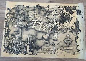
Drawn and signed by the artist cartographer Bryan Thomas in 1978. Unframed, on paper it measures circa 635mm by 450mm
×

Drawn and signed by the artist cartographer Bryan Thomas in 1978. Unframed, on paper it measures circa 635mm by 450mm